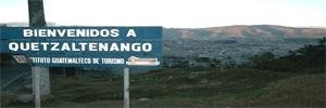
Quetzaltenango
ABOUT QUETZALTENANGO also called Xela (Shay-la)
|
 sq. mi.), with a cool climate in the highlands and warm on the coastal area. The languages spoken in the area are Spanish, Quiche and Mam.
CITY OF QUETZALTENANGO:
It is currenty considered as the second most important city of Guatemala, due to its size, industrial, cultural, and commercial activity. It has preserved its colonial architecture.
Several neo-classical buildings can be
seen, among which are those located around the Centroamérica Park, considered the heart of the city. East of the plaza lies the Espíritu Santo (Holly Spirit) Cathedral with its two facades. The first one, first constructed in 1535, is very ornamented, and the latter, of neo-classical style, forms part of a structure made of several domes which dates back to 1899.
On the south end of the park is another building with such characteristics, called La Casa de la Cultura, Where the Natural History Museum is housed, and which contains a collection of pre-hispanic pieces and historical memorabilia. . This is also the site of the Information Office of the Guatemala Tourism Board, or INGUAT.
The Municipal Theater is located at 1st streets, between 14th and
14th “A” Avenues, and is decorated with several busts of local scholars.
Colorful inclined stone-convered streets that rise and fall, redroofed house, parks and churches, and mansions built by the rich local coffee growers are part of the urban landscape of the city.
On the outskirts of the city is located the cerro el Baul, from where one can get a mafificent view of the city and the surrounding mountains.
Xelajú, as this city is known, has an altitude of 2,333 meters (4374 ft) a.s.l., and has a cold and humid climate.
The most important celebration that take place at the city is the city fair, which runs froms Septembers 12th to the 18th, with the famous Central American Floral Parade.
“Xela” is located 206 kilometers (128 miles) from Guatemala City, and is reached by taking the Pan-American E highway, or 234 filometers via the internactional Pacific highway.
Quetzaltenang’s surroundings include several villages and tourist sites, of Quiché and Mam origin, and that have several small plazas with amazing colonial-style churches, where the tourist can appreciate the agricultural and handicraft richness of the region on market days. For this reason, it is recommended that this city be used as an operations center.